 English
 日本語
日本語
 Français
 Español
 Deutsch
UAS Ecosystem
Coyote V
System Overview
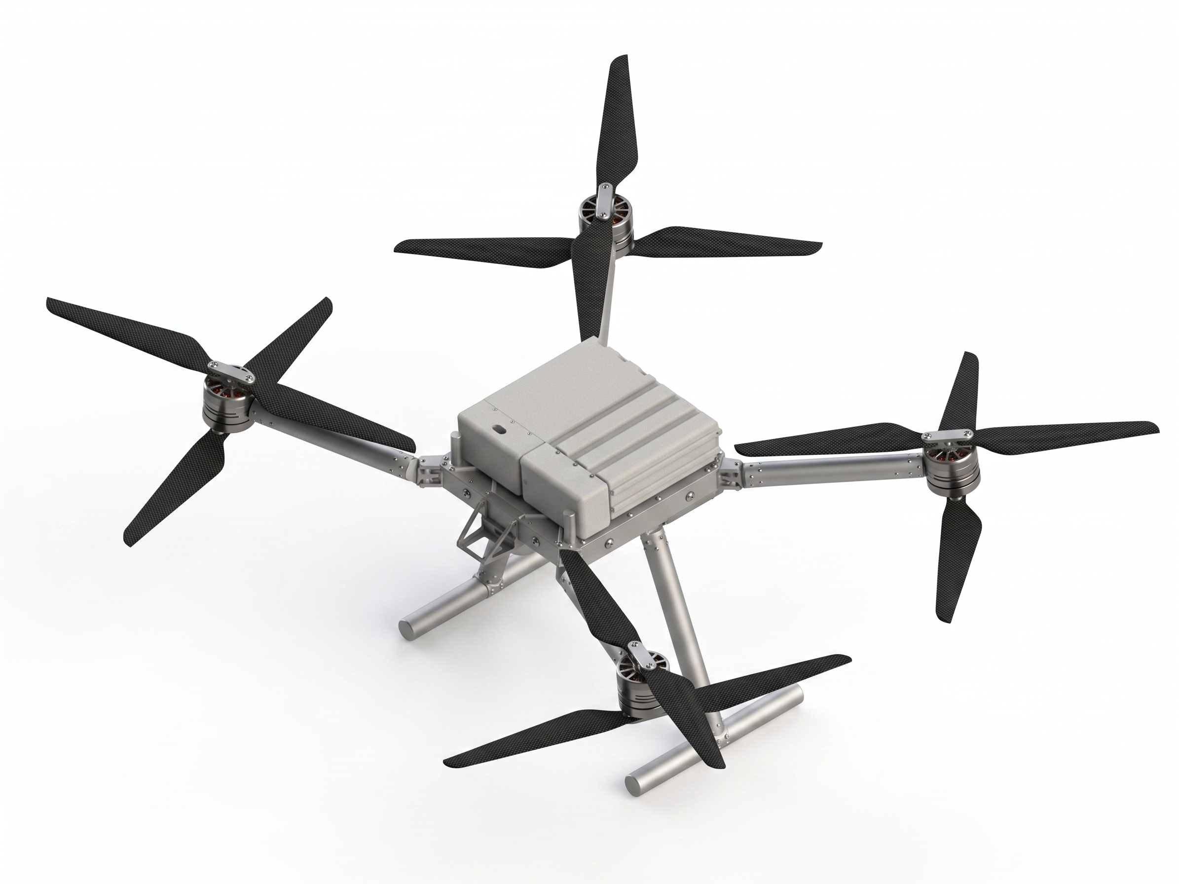
VTOL Integration and detailed specifications for Coyote V.
The Coyote V is engineered for advanced aerial cinematography and inspection. It features an unobstructed bottom profile for gimbal camera mounting, ensuring propellers never enter the field of view during high-angle shots.
Technical Specifications
GPS: ±1m (H), ±0.5m (V)
Dynamic Spatial Coordinate Generation (DSCG)
Integrated with Smartmicro DRVEGRD 169 Radar and OUSTER OS1 MAX LiDAR, the platform provides persistent, real-time spatial awareness. Utilizing onboard edge computing, it continuously generates absolute GPS coordinates for multiple monitored reference points—referenced dynamically against the platform’s own RTK positioning. Designed to relay encrypted coordinate telemetry back to the Ground Control Station (GCS) and secondary relay stations with sub-50ms latency, enabling high-fidelity, actionable mapping of critical infrastructure and mobile assets.
Developer & Integration Center
Taiwan UAS Group supports professional system integrators. Request technical documentation including Interface Control Documents (ICD), electrical requirements, and payload integration guides.
Request Integration Access